There is a particular fantasy bundled into the off grid dream, and it tends to show up somewhere between the solar panel spreadsheet and the well drilling quote. The fantasy is that if you buy enough acreage in a county nobody has heard of, cut the utility cord, and stop handing your address to strangers, you become invisible.
The word people reach for is untraceable. They picture a cabin that exists nowhere except in their own memory, a parcel no database has ever indexed, a life that leaves behind no residue at all.
That picture falls apart quickly once you understand how modern land information actually works. Every acre in the country sits inside a recorded chain of title. Every county maintains a parcel layer that feeds a public web map. Federal agencies photograph the entire lower forty-eight on a rolling schedule and give the imagery away for free.
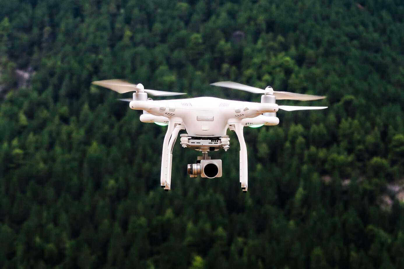
Hobbyists with eight-hundred-dollar quadcopters now produce aerial mosaics sharper than anything the government flew twenty years ago, and insurance carriers, wildfire modelers, timber companies, and assessors all buy imagery products that refresh several times a year.
None of that makes off grid living pointless, and none of it means you have no privacy left. It does mean the word untraceable is carrying weight it cannot hold. What you actually gain when you move off grid is distance, friction, and obscurity, three things that are genuinely valuable and completely different from invisibility.
The pages ahead walk through the specific systems that make rural property findable, explain what each one captures and what it misses, and offer practical ways to shrink your visible footprint while staying firmly on the right side of the law.
The Myth of the Untraceable Homestead
Ask around in any homesteading forum and you will find someone convinced that the right combination of cash purchase, remote acreage, and refusal to file paperwork produces a genuinely untraceable place to live. The belief is understandable because rural counties feel sleepy, government offices feel underfunded, and nobody has ever driven past the end of your road except the propane guy. The problem is that traceability in land is not a function of how often someone visits. It is a function of how the records were built in the first place, and those records were built to be permanent.
American land tenure rests on the recording system, a body of public documents whose entire purpose is to make ownership knowable to strangers. That system predates the internet by centuries and was never designed with any privacy protection in mind. It was designed so that a buyer in 1840 could walk into a courthouse and find out whether the man selling him a farm actually owned it. Everything since then, including digitization, parcel viewers, and commercial data resale, has simply made that same information faster to retrieve.
Layered on top of the records is a second reality that surprises people even more. Your land gets photographed whether or not you ever fill out a form. Aerial and satellite programs run on schedules that have nothing to do with you, and they do not ask permission from landowners before flying. So, the untraceable homestead exists mostly as a mental image. The real question worth asking is not how to disappear but how much of your life ends up legible to someone who goes looking, and how much of that you can reasonably reduce.
Your Deed Becomes Public Record the Day You Sign It
The first and largest crack in the untraceable theory opens at closing. When a deed is recorded at the county register of deeds or county clerk, it enters a public index that is searchable by grantor name, grantee name, legal description, and instrument number. That index is not a courtesy. In most states, recording is what protects your ownership claim against competing claims, which means the act of securing your property and the act of publishing your name are the same act.
Recorded instruments carry more than a name. They usually include the legal description, the acreage, the consideration paid or a transfer tax stamp from which the price can be inferred, and often a mailing address for tax notices. Deeds of trust and mortgages add a lender, a loan amount, and sometimes a maturity date. Easements record who has the right to cross your land and where. Mineral and timber reservations record what somebody else still owns underneath or above you.
A common workaround is to title the parcel in an LLC or a trust, and that does add a layer. It does not create anything untraceable, though, because the entity itself files with a secretary of state, and depending on the jurisdiction, the registered agent, organizer, or member may appear in that filing. Federal beneficial ownership reporting has moved in and out of enforcement in recent years, which adds uncertainty rather than protection.
Anonymity through entity structuring is best understood as friction. It makes casual searching harder and slows down data brokers who scrape by owner name. Anyone with a subpoena, a title company account, or genuine patience still gets there.
Assessors, Tax Rolls, and Why Rural Parcels Are Never Untraceable
If the deed puts your name in the index, the assessor puts your buildings on the map. Every county needs a defensible valuation for every parcel inside its boundaries, and modern assessment offices maintain that valuation inside a geographic information system with a parcel polygon, a parcel identification number, and an attribute table describing improvements. That table is where an off-grid property stops being untraceable in any practical sense.
Assessment records typically list structure square footage, year built, construction type, number of stories, outbuildings, well and septic presence, road frontage, and land classification. Many counties publish this through a public parcel viewer where anyone can click a shape and read the whole record. Others sell bulk exports to commercial aggregators who republish the same data on real estate sites with better search functions than the county ever had.
Here is the part that catches homesteaders off guard. Assessors do not need you to report a new cabin. They compare imagery year over year, flag parcels where a roof appeared, and send a field appraiser or simply adjust the value and mail you a notice. Change detection against aerial photography has been standard practice in assessment for well over a decade because it is far cheaper than driving every road in the county.
So a cabin built quietly on forty acres, with no permit and no utility hookup, still tends to surface within a valuation cycle or two. The property was never untraceable. It was just unvalued for a while, and the gap between those two states is usually measured in months rather than decades.
Satellite Imagery Got Cheap, Frequent, and Uncomfortably Sharp
The satellite picture people carry in their heads is roughly fifteen years out of date. They imagine grainy, expensive, occasional coverage that only governments could afford. What actually exists now is a layered market. At the free end, the Landsat archive stretches back to 1972 and remains fully open to the public through federal portals, giving anyone the ability to watch a landscape change across half a century. Resolution there is coarse, around thirty meters, so it shows clearing and road cuts rather than rooflines.
The middle tier is where privacy assumptions really break. The National Agriculture Imagery Program flies the contiguous United States during growing season at sub meter resolution and releases the results publicly. At sixty-centimeter ground sample distance, a shipping container, a greenhouse, a gravel turnaround, and a solar array are all individually identifiable. That imagery is free, it is national in scope, and it has been running since 2002, which means most rural parcels have a photographic time series going back two decades.
Commercial constellations sit above that again, offering daily revisit at resolutions fine enough to count vehicles. Those products cost money, but the buyers are not exotic. Insurance underwriters, agricultural lenders, utilities, conservation groups, and litigation support firms all subscribe.
The practical takeaway for anyone hoping to be untraceable is uncomfortable. Your land has been photographed repeatedly, the older frames are archived, and nothing you do now removes the historical record. Someone can pull up the year you cleared the pad, the year the roof went on, and the year the pond filled.
Drones Filled the Gap Between the Road and Orbit
Satellites answer the question of what is on the parcel. Drones answer the question of what it looks like up close, and they arrived fast enough that neither law nor social norms have fully caught up. A small quadcopter that costs less than a used chainsaw can capture centimeter level detail, fly a mapping grid autonomously, and stitch the result into a model accurate enough to measure a woodpile.
Who is actually flying them over rural land is a longer list than most people assume. County assessors contract mapping flights. Utilities inspect line corridors. Timber and agricultural operators survey stands and fields. Real estate agents shoot neighboring listings. Search and rescue teams train. Neighbors with a grudge occasionally take an interest. Commercial and public agency flights operate under federal rules that set altitude ceilings, visual line of sight requirements, and pilot certification standards.
The legal landscape underneath those flights is genuinely unsettled, and privacy advocates have documented how thin backyard protections have become as drone use spreads across law enforcement and private hands alike. Several states have passed statutes restricting warrantless government drone surveillance, and a smaller number address private operators, but the coverage is patchy and varies enormously by state.
For the off-grid landowner, the operational lesson is simple. Tree cover and terrain that hide you from the road do very little against something hovering at two hundred feet. Being remote and being untraceable diverge sharply the moment the observer gains altitude, and altitude now costs almost nothing.
Permits, Septic Approvals, and the Paper Trail Behind Every Cabin
Even people who accept the imagery problem tend to underestimate the document problem. Building a place to live generates paperwork across several agencies, most of which have nothing to do with each other and all of which retain records indefinitely. A septic system usually requires a soil evaluation and a permit from a county or state health department, complete with a site plan showing tank and field locations relative to the structure. A well often requires a driller’s log filed with a state water agency, including depth, casing, yield, and coordinates.
Driveway access onto a public road generally needs an encroachment permit from the road authority. Any land disturbance above a certain acreage triggers stormwater review. Bringing in a manufactured home creates a title transfer record. Even a rainwater catchment system or a graywater setup falls under permitting in some western states.
Choosing to skip these steps does not make the resulting structure untraceable. It converts a permitting record into a code enforcement record, which is worse from a privacy standpoint because enforcement files often include complaint narratives, inspector photographs, and correspondence. Unpermitted work also surfaces later at the least convenient moment, during a sale, an insurance claim, a refinance, or an estate settlement.
There is a version of off-grid living that treats compliance as the enemy of independence. The practical counterargument is that a completed permit file is a boring, closed document, while an open violation is an active file that grows attention over time. If your goal is to be left alone, finished paperwork serves that goal better than missing paperwork.
Address Points, 911 Mapping, and the Quiet Municipal Layer
Long after you stop giving out your address, your address keeps existing. Nearly every county in the country now maintains an address point layer built for emergency dispatch, and those points are placed at structures rather than at driveways or mailboxes. The layer exists so an ambulance can find a specific building on a specific parcel at two in the morning, which is a good reason for it to exist and also a reason your cabin sits in a database you never interacted with.
Address point creation is usually triggered by a permit, a utility connection, or a request for emergency service, but it also happens through routine imagery review by the addressing coordinator. Once created, the point propagates. It feeds the county parcel viewer, the state address repository, the national address dataset used by federal agencies, and often commercial mapping providers who license government data.
Around that sit related layers most people never think about. Road centerlines with names and jurisdiction. Fire district and school district boundaries. Broadband availability reporting collected at the location level. Floodplain and wildfire risk models that operate on structure footprints derived from imagery and machine learning.
The cumulative effect is that a structure becomes a known object in several systems at once. No single one of these makes a property untraceable or traceable by itself. Together they mean a determined searcher rarely needs to work hard. They need a name, a county, and about twenty minutes with three public websites, and the rest assembles itself from data that was never really private to begin with.
What Stays Untraceable and What Never Will
Being honest about the limits cuts both ways, because plenty of things about your life genuinely do stay outside the record. Location and structures are heavily documented. Behavior, routine, belief, association, and daily activity are not, at least not through these particular channels.
Aerial imagery shows a roof, not who sleeps under it. Assessment records show square footage, not what you do inside. A parcel viewer shows a polygon, not your schedule, your health, your finances beyond the recorded loan, or your relationships. The recording system tracks title, and title is a narrow slice of a life.
Courts have wrestled with where the line falls, and the results are less protective than most landowners expect. A 1989 Supreme Court decision held that observation from a helicopter at four hundred feet did not require a warrant, because the airspace was one members of the public might lawfully occupy. That reasoning has aged strangely in an era when the public routinely occupies that airspace with cameras attached.
So, what is realistically untraceable is not your property but the texture of your life on it. That distinction matters for planning. If your privacy goals are about who knows the shape of your day, off grid living delivers enormously well. If your goals depend on nobody knowing that a structure exists at a given coordinate, the plan is built on sand, and you are better served by adjusting the goal than by chasing an untraceable status that the underlying systems will not permit.
Lowering Your Visibility Without Breaking Any Laws
Accepting that untraceable is off the table frees you to pursue the achievable version, which is reducing unnecessary exposure. Start with the layer you control most directly, which is correspondence and identity. Use a separate mailing address for anything that does not legally require your situs address. A commercial mail receiving agency or a post office box keeps your physical location out of vendor databases, subscription lists, warranty registrations, and the marketing files those feed.
Title structure is worth real thought. An LLC formed in a state with modest disclosure requirements, paired with a professional registered agent, keeps your personal name off the surface of the deed index. Pair that with a trust for succession purposes and you have reduced casual searchability significantly without pretending it is bulletproof.
Trim your own emissions. Photographs posted online with intact location metadata are a far more common leak than any satellite. Public records requests filed under your own name become public records themselves. Reviews, forum posts, hunting lease listings, and equipment resale ads all quietly triangulate a location.
On the physical side, think about screening rather than concealment. Vegetation buffers along road frontage, structure placement under existing canopy, matte and earth toned roofing instead of bright metal, and equipment stored under cover all reduce how much detail an aerial frame yields. A shade sail or heavy-duty privacy screen mesh over an outdoor work area does more than people expect. None of this makes you untraceable. All of it lowers the resolution of what a casual observer collects.
Gear That Helps You Manage Your Own Footprint
Equipment will not deliver an untraceable property, but a few categories genuinely help you understand and manage what is visible. The first is monitoring your own perimeter. A set of cellular or SD card trail cameras placed along access points tells you who actually comes down your road, which is more useful than speculating about it. Knowing that a survey crew walked your line in March changes how you interpret an assessment notice in September.
The second category is airspace awareness. Consumer radio frequency detectors that pick up common drone control and video links will tell you when something is operating nearby, and while detection is not prevention, it converts an invisible event into a known one. Log what you observe, note dates and times, and you have documentation if a pattern emerges that warrants a conversation with a lawyer.
Third is visual signature management. Camouflage netting and shade cloth over parked equipment, fuel storage, and work areas reduce contrast in overhead imagery and also extend the life of whatever sits underneath. Choose materials rated for sun exposure rather than costume grade netting that shreds in a season.
Fourth is the document side, which people neglect badly. A cross cut shredder for anything carrying your name and address prevents the oldest and least technical form of tracing, and it costs almost nothing. Combine that with a fireproof document safe for deeds, permits, well logs, and survey plats so your own records stay organized and under your control.
My Two Cents
After years of watching people chase this, my honest read is that the word untraceable does more damage to good planning than any surveillance technology does. It sets an impossible bar, and when people realize they cannot clear it, they often swing to the opposite extreme and stop protecting the things they actually could have protected. That is the real cost of the myth.
The version I would build looks like this. Accept that the parcel is documented and always will be. Keep the paperwork clean and closed rather than open and contested, because a finished permit file attracts far less attention than an enforcement case. Put a layer between your personal name and the public index through sensible titling. Keep your mailing address separate from your living address. Manage what you publish about yourself, since your own posts leak more than orbit ever will.
Then spend the rest of your energy on the part that genuinely stays yours, which is how you live once you are there. Nobody is photographing your mornings. No assessor records what you read, who you love, or what you believe. That is a substantial amount of privacy by any historical standard, and it is real in a way that untraceable never was. Build for obscurity and independence, not for invisibility, and you will end up with something durable.
Author Bio
Bob Rodgers is a lifelong outdoorsman, herbalist, and seasoned prepper with over 20 years of real-world survival experience. As the founder of PreppersWill.com, he shares practical advice on self-reliance, off-grid living, and disaster preparedness, no hype, just hard-earned lessons from decades of hands-on prepping.
Suggested resources for preppers:
Food preps when you lack money
The #1 food of Americans during the Great Depression
Survival Foods of the Native Americans
If you see this plant when foraging, don’t touch it!
